Posts Tagged ‘pdx hiking’

Tanner Butte – Columbia River Gorge 2/1/11

Garmin Interactive Map

20.7 mi

Elevation Gain:
5,806 ft

Min / Max Elevation:
78 ft / 4,111 ft

Matt, Dexter, Sadie & I

Tanner Butte had been a hike on my ‘ to hike list’ for along time. Its one of the many higher mileage day hikes in the Columbia River Gorge. I had finally dedicated myself to getting an early enough start to have the opportunity to finish before dark.

The trailhead starts in an awkward spot right off of exit 40 (Bonneville Dam). You can either park at the Wahclella Falls trailhead (just to the right/South as you come off i84) or the Tooth Rock parking lot (just left/East at the fork). Tooth Rock parking is free and is known for access to the Columbia River Gorge Historic Highway that has been converted into a walking / biking path in different sections. Tooth Rock is just West of Eagle Creek (Punch Bowl Falls & Tunnel Falls) and serves as the trailhead for Wauna Viewpoint. We parked at the Wahclella Falls trailhead (requires a NW Forest Pass) .

From the parking lot you walk back (North) towards i84 where the road forks – the hike begins here. The trailhead is halfway decently marked, but beyond this good luck…

Matt and I brought information about the hike; however, it did not completely help as there were many unmarked and obscure roads. We explored a few roads and one finally led us to the top of some ridge dead-ending. Discouraged as we were hiking down we started to plot our itinerary for the rest of the day – possibly hitting up a couple other hikes in the area. We ended up giving it one last shot and found the correct road, which led us to the Tanner Butte Trailhead … finally!

Apparently back in the day you were able to drive to the real Tanner Butte Trailhead. From the get-go the trail is beautiful! It starts with a series of small cascading waterfalls. We had to hike across a small icy creek that required some rock-hoping preplanning to prevent getting wet. My dog Dexter loved walking through the creek hydrating while my brothers dog Sadie is still deathly afraid of water. Sadie would not budge – I had to grab her scruff and pull her across the creek. This didn’t wade well for my feet as they got slightly damp with many more miles to go.

There was a strong East wind that kept the air brisk – chilly brisk that is! Needless to say, I wasn’t willing to bust out my camera much and sacrifice my hands freezing. Much of the hike we stayed in the dense forest somewhat protected from the wicked East wind of the Columbia River Gorge.

IMG_2615

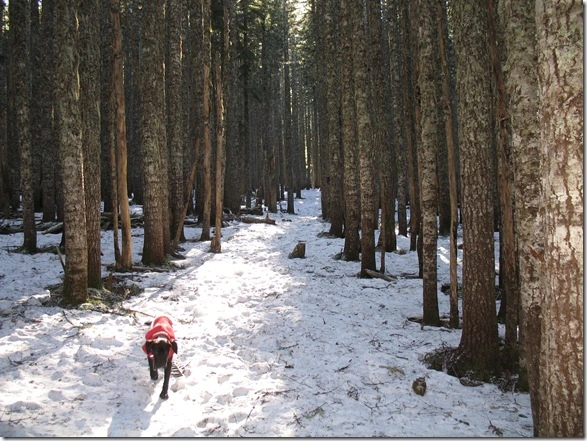
[The Snowy Tanner Butte Trail – Dexter loves to run ahead]

Luckily once we got onto the Tanner Butte trail it was mostly easy to follow. As you can see above the trail clearly cuts through the forest. Sections of the trail we hiked were actually an old road. There was a few areas where it almost got away from us (due to the deceiving snow) that we took loose tree limps and logs to clearly mark  the trail to see on the way back.

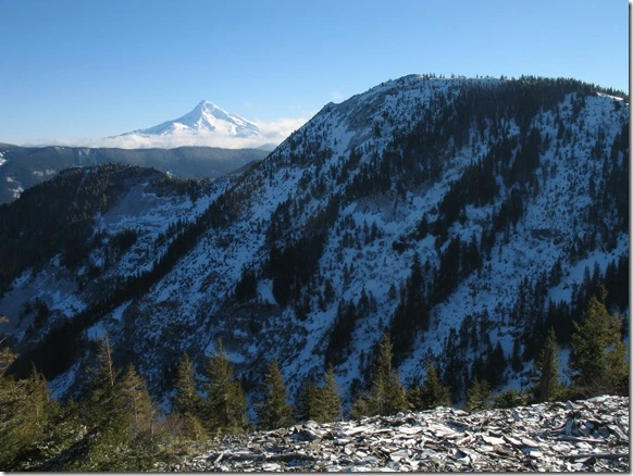
The snow level had been at a high elevation for awhile leading up to this trip, but since much of the trail hikes through dense forest the snow is protected from the sun leaving us to hike though it. Most of the way the snow was firm and icy. As the snow melted off the tops of the trees the moisture created divots in the snow – this was definitely wearing on your feet and ankles causing your foot strike changed constantly. Hiking a few miles through this type of terrain slowed us down tremendously. As we reach a vista we felt like we were near the summit, but it was a false summit – a beautiful vantage point though!

IMG_2619

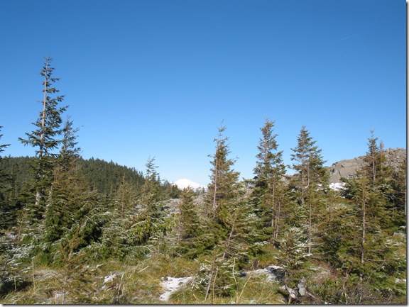
[Mt Hood with Tanner Butte in the near distance]

It was starting to get late in the day so we had to make some difficult decisions. From the ‘false summit’ we decided to give the summit a shot. After a half mile or so the trail disappeared as did our summit fever. The snow had gotten thicker and icier and the forest had grown a few too many trees leaving us to poor visibility. Just a few hundred vertical feet from the summit we decided it was best to not show up in the news and turn around.

IMG_2620

[Mt Adams in the distance]

When hiking you see so many different things – when you are leading vs following or when you are going ‘out’ or coming ‘back.’ As we were hiking ‘back’ we got a glimpse of Mt Adams in the distance.

IMG_2621

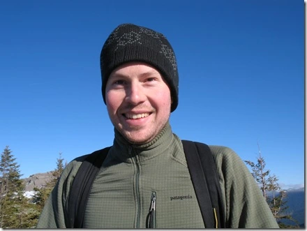
[Matt in good spirits]

The decision to turn around or keep trekking is a difficult one to make. Like many, I want to reach my final destination – the summit! However, there are many factors that are considered prior to turning around – time/day light, trail conditions, supplies packed, individual’s fatigue. We probably would have been okay, but didn’t want to risk coming back to the wrath of our significant others for arriving way late 😉
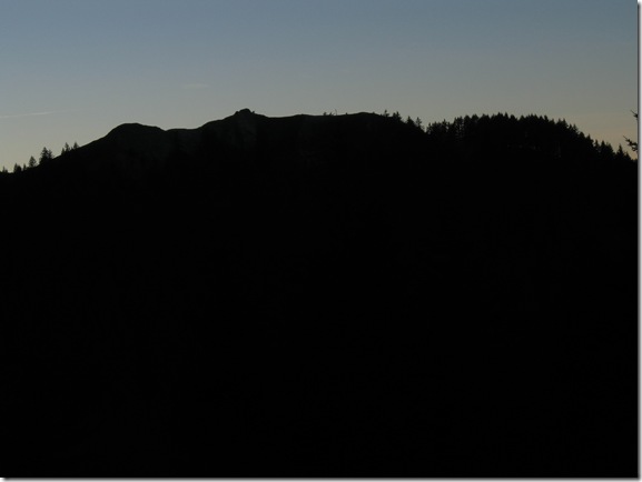
IMG_2624[Munra Point just West of us]

On the way back we took full advantage of the downhill keeping a solid pace. With just a couple miles left the sun started to set behind the might ridges of the Columbia River Gorge. It made for a cool shot of Munra Point and reminded me of how steep of a climb it was!  We arrived back to the car just as it was nearing complete darkness. The dogs fell asleep instantly as they probably put in double the mileage we did!
Hamilton Mountain

2,480 Feet
9.4 miles Round Trip
Andrew and myself
Hamilton Mountain Hiking Photos
NW Hiker Trail Info

Andrew and I adventured off late in the day in “THE VAN” into the great Columbia River Gorge to pursue and conquer Hamilton Mountain. I had hiked Hamilton Mountain just a few weeks earlier, but decided to hike it again because Andrew had hiked most trails in the Western Gorge except for this one.

Our adventure started off with driving along the Scenic Washington Highway 14 – mostly just to avoid having to fork out the $1 (each way) it costs to cross The Bridge of the Gods. The drive is nice (of course once you pass the Camas Mill). The road is rolling and curvy in parts offering great views of the Columbia River Gorge from the perspective on the Washington side.

As we approached the turn off for Hamilton Mountain (just Northwest of Beacon Rock off of Highway 14) we decided to pull off at Beacon Rock first. While in the parking lot I learned that Andrew had not been to the top of Beacon either – completely astonished I geared up and prepared for the heavy winds that were going to welcome us at the top.

After our short little walk up Beacon Rock based on time our original plan was to run up to the Pool of the Winds Waterfall – hang out for a bit, do lunch up there and head back.

[the pool – lots of unexpected water for this time of year!]

After taking a few minutes to check out the falls Andrew made the executive decision to hike to the top of Hamilton Mountain. Like every other time I’ve hiked this trail we started with the “more difficult” trail then looping back down on the more gradual trail.

On the way up to the summit we moved quickly stopping occasionally for just a few moments to drink water and alternate carrying our one pack. Once atop Hamilton Mountain we wolfed down a couple of sandwiches to rejuvenate us for the trek down. We didn’t stay long at the summit as the winds were still just as blustery as they were atop Beacon Rock. For how crazy the weather was I was still able to snap a few good shots of my surroundings –

[Mt Adams from the top of Hamilton Mt looking East]

[Atop Hamilton Mt look directly South at snow-covered Mt Hood]

[Looking East in the Columbia River Gorge with the Dam beneath]

After our short break at the top we hiked North along the ridge to start our looping descent. With the combination of the colder weather, time deadlines, and beautiful downhill trail – the hike quickly turned into an all out trail run. We would run about a half mile or so then slow er’ down for a few letting our fragile knees take a short break for the intense pounding then continue down. Needless to say, we got down in a hurry!

For more info and a detailed write up on Hamilton Mountain you can read up on the first time I hiked it this year – Hamilton Mountain.

Wahclella Falls

300 Feet
2 miles Round Trip
Brian, Myself
Wahclella Falls Hiking Photos

NW Hiker Trail Info

Wahclella Falls is a great waterfall that sits back off about one mile in a small canyon. The hike starts with walking along a service road, which leads to an odd fish ladder structure that is constantly monitored.

Just beyond the fish ladder structure the access road turns into a wide trail following the Tanner Creek upstream. The trail crosses over a short bridge, which was built because of the great amount of run off from snow melt. There is a great waterfall that rushes down the rock face flowing into Tanner Creek. I always enjoy hiking many of the trails of the gorge during the rainy/ wet season because there are more seasonal waterfalls visible and the year around falls are much more powerful.

About a half mile into the hike you will come to a trail juncture, which allows you to do a looping hike. I always veer to the left hiking up the steeper trail – getting the more difficult part out of the way first and plus there are fewer people that choose this direction (the first 100 ft or so is kind of steep so it looks a little daunting, but then it levels out).

The canyon is wide and open with a good amount of trees and vegetation. Even with how open the canyon feels Wahclella Falls still seems extremely huge and powerful. Wahclella Falls is a two part falls also including a small side falls (winter run off) that flows into the mid section. The force of the water falling creates a mist that can carries a long ways giving you a taste of the chilliness of the frigid ice cold water.

[Wahclella Falls – with the mist getting to the lens of my camera]

After snapping a few quick shots before getting completely soaked we retreat to the other side of Tanner Creek – a much more protected area from the cold misting falls. The creek is much more calm and clear, but the current is still swift.  The canyon walls are formed by aged basalt columns that have eroded over time. In one area there is a small cave that goes a surprisingly long ways (further depending on how big you are/ how claustrophobic you are as well). I geared up with a headlamp and began my short-lived spelunking journey and was quickly distracted with a lizard crawling in the distance.

[A good ole cave lizard]

We continued our loop along the Westside of the canyon. Making the loop gives you great perspective of the size of the canyon. Along the Westside of the canyon you are at a better vantage point to view Tanner Creek. The white water makes it tempting to want to kayak.

Just as we were leaving the sun started to shine through the clouds and more people started to show up. This hike is a great family trail – its short, relatively easy and there is some great educational opportunities along the trail (wildflowers, wildlife, etc). Also, depending on how ambitious you are feeling this could be either a starting/ending hike – there are many other great hikes that can be accessed from the same parking area.

Wauna Viewpoint

850 Feet
4 miles Round Trip
Brian and myself
Wauna Viewpoint Hiking Photos
NW Hiker Trail Info

This is one of my favorite hikes because of the awesome panoramic views of the Columbia River Gorge. It is fairly short with a steady climb that seems to be uncrowded even on the sunniest days.

Due to such an awesome trail network in the Columbia River Gorge you have many options… You can start from Eagle Creek trail and walk across the suspension bridge and head West or begin at the Tooth Rock Trail and begin hiking East. I prefer the Tooth Rock trailhead merely because it seems to always be uncrowded and you have options of doing another short and sweet hike – Wahclella Falls Hike 2 miles round trip.

The trail isn’t the greatest when it comes to signage so I suggest bringing a guide book/map and allowing sufficient time to find your way to the viewpoint. We brought a couple of different guide books – Sir William Sullivan’s guide book as well as a topography map detailing all trails in the area.

After a short hike in the dense forrest you start to climb above the trees a bit with teasing views of what is even better atop at Wauana Viewpoint. You must ignore the power lines to enjoy it.

[Atop of Wauna Viewpoint looking East with Eagle Creek just below]

We decided to make a loop out  of this hike – so at the trail juncture not far from the top we hiked East towards Eagle Creek. After a short stint along this soft rolling trail we arrived to The Columbia Rive Gorge Old Historic Highway. Parts of this historic road have been either updated for use of the modern day vehicles to travel or converted into bikeways/walking paths.

The Columbia River Gorge Historic Highway is a beautifully constructed road that was well thought out having travelers experience the best of the Columbia River Gorge Scenic Area. The road takes you to the greatest viewpoints of the Columbia River Gorge including  6 viewable waterfalls from the road (Horsetail Falls, Multnomah Falls, Wahkeena Falls, Bridal Veil Falls, Sheppards Dell Falls, and Latourell Falls just to name a few) and amazing view points (Crown Point Vista House, Portland Womens Forum and many others similar to the picture above). I highly recommend taking off with your hiking boots or bicycle to check out the gems of the gorge…